Keep these online resources handy in case of floods, fires, quakes and other disasters
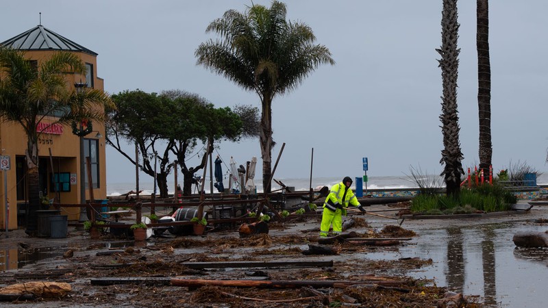
Workers clean up after flooding in Capitola Village. Rosangela Perry Shutterstock
Residents of California are no strangers to disaster, whether it comes in the form of raging wildfires, overflowing creeks, towering waves, rumbling mudslides or rocking faultlines. (And of course there’s always the spectre of megadrought lurking.) We all know we need to have a “go bag” packed and ready. But we also can prepare by keeping crucial information right at our fingertips—just one touch away on our smartphones. And should those smartphones run out of juice or out of cell range, we’ve also listed information sources for radio and television.
One key element in being prepared is to sign up for CruzAware, a community notification system that sends crucial messages in emergency situations. The community alert and warning system, which replaced the old CodeRED, was launched in June 2023 by Santa Cruz County and Santa Cruz Regional 9-1-1. According to the county, CruzAware is a significant upgrade over the previous system, with a range of enhanced features to ensure effective communication during emergency and non-emergency situations. In additional to providing vital information during emergencies, CruzAware offers a messaging platform for residents in unincoporated areas to receive notifications regarding roadwork and other neighborhood-level disruptions. Users can set their preferred language and communication options, including phone calls, text messages and/or email. CruzAware also has a free mobile app, available across all platforms. To find out more and sign up for emergency notifications, visit CruzAware.org.
In an emergency, there’s no such thing as too much information. Launched in 2007, NIXLE provides an “open communication forum” that connects more than 8,000 public safety agencies, municipalities, schools and other entities with members of the public. The notification service delivers texts, email and voice messages, as well as information through social media and the Nixle mobile app. Santa Cruz County residents can register at this link for alerts from local agencies. And if you work in a different county, have a second home, or just want to stay apprised of emergency situations that may affect friends and relatives, you can sign up for alerts in other areas.
You can also sign up for Nixle quickly by texting your ZIP code to 888777 to opt in for text messages.
The Warning, Alert and Response Network (WARN) Act established Wireless Emergency Alerts in 2008 and it became operational in 2012. WEA is a national public safety system that allows customers with mobile devices to receive geographically targeted messages about imminent local threats. To activate WEA, make sure your cell phone is set up to accept emergency and public safety alerts. (According to the FCC, “Wireless service customers should check with their wireless service provider to find out if their cell phone or mobile device is WEA-capable. Not all wireless service providers offer WEA.”)
Another source of data is the National Oceanic and Atmospheric Administration Weather Radio alert system. When this nifty device is properly programmed, the National Weather Service can remotely turn it on and send basic alerts for floods and wildfires. NOAA Weather Radio receivers come in a variety of sizes and styles in electronics stores or online; the cost ranges from $25 to $100. To learn more, watch this NOAA Weather Radio Set-Up Video on YouTube. Santa Cruz County residents should tune their NOAA radio to the nearest channels: San Francisco (162.400), Monterey (162.550) and Monterey Marine (162.450). Find additional information on this PDF produced by Santa Cruz County.
Old-fashioned terrestrial radio and television stations make up an important part of the country’s emergency alert system. KSCO (1080 AM) is the official local emergency broadcast station, but information can also be found on KSQD; listen on the airwaves at 90.7 FM or via livestream at KSQD.org. Other local stations include KPIG (107.5 FM) and KZSC (88.1 FM). Also watch for alerts on these television stations: KSBW (Channel 8) and KION 46 KION (Channel 46).
CodeRED messages and other alerts can help you stay safe, but if evacuation orders are issued, you need to know which zone your house or workplace is located in. Find your zone by viewing this map. And bookmark Aware.Zonehaven.com on your phone and computer so you can monitor conditions when you are traveling.
When it comes to getting around in a disaster, California Local offers real-time assistance with our Santa Cruz Traffic & Transportaion overview page. In addition to a highway map marked with incidents and alerts, the page features links to information on Highway 17, Caltrans roadwork, road closures, and transportaion services.
One of the best of these—definitely worthy of its own bookmark—is Santa Cruz County’s Current Road Advisories site, updated continually to show road closures, highway construction areas, and hazardous situations such as fallen trees, flooding or downed utility poles.
Cal Fire, the state agency responsible for fighting California’s wildfires, offers tools that can be used via smartphone. Sign up for text alerts at Incidents.ReadyForWildfire.org. And if you’re on the move, bookmark Cal Fire’s statewide map of current fires at Fire.ca.gov/Incidents.
Fire and rain often come with another unwelcome side effect: power outages. To find out where the power is out and and how long it will be before the lights come back on, visit PG&E’s alerts page, which provides a map of current outages and future Public Safety Power Shutoff (PSPS) incidents.
Not too long ago, earthquakes came without any warning. Now, it is possible to get a little notice, thanks to a couple of apps. The QuakeAlertUSA app, from Early Warning Labs—available for free on the Apple App and Google Play stores—works in California and Oregon. Data detected by sensors managed by the United States Geological Survey determine the location and size of a quake, and the Early Warning Labs cloud server calculates individual alerts. Learn more: EarlyWarningLabs.com/mobile-app.
From UC Berkeley, the MyShake app is a citizen science project to build a global earthquake early warning network. The app, which monitors sensors on participants’ smartphones, is free in the Apple App and Google Play stores. Alerts are only available in California, Oregon and Washington at present, but folks around the world can participate. Learn more: MyShake.berkeley.edu.
California Local’s Santa Cruz County Weather overview page serves as a portal to precipitation data and more, with a five-day forecast and weather alerts on floods, high winds and high surf. There are also links to 15 resource sites and—newly added this month—links to data from NOAA on river and stream water levels.
Other bookmark-worthy sites are SantaCruz.OneRain.com, which provides data from precipitation monitoring sites throughout the county, and S.A.F.E.R. (Situational Awareness For Emergency Response), which maps flooding danger.
In Santa Cruz County, disasters fall under the purview of the Office of Response, Recovery and Resilience, which was created in December 2020—just a few months after the CZU fire. To keep up with the latest from OR3, sign up here for the e-newsletter.
Santa Cruz County has set up a Rainstorm Call Center at (831) 454-2285. Call with storm-related queries, including questions about shelter locations.
Watsonville emergency hotline: (831) 768-3038.
To report county road issues in the unincorporated areas, call (831) 477-3999.
Follow Santa Cruz County’s Facebook page and Twitter account for updates during disasters.
Current information can also be found on the Twitter account for the Santa Cruz County Sheriff’s Office.
When this resource list was first posted, on Jan. 8, 2023, storms fueled by atmospheric rivers had just brutalized Santa Cruz County. Waves pummeled Capitola Village and the Santa Cruz Wharf; flooding hit hard in Rio Del Mar. And the days ahead are bringing more rain. Hopefully, though, we’re still very far away from how bad things could get. For a glimpse at what those situations might look like, check out FEMA’s 100 Year Flood Hazard Areas and Santa Cruz County’s Tsunami Inundation Zone Viewer.